| Bibliography | Background | Hypotheses | Home | |
| Bibliography | Background | Hypotheses | Home | |
![]()
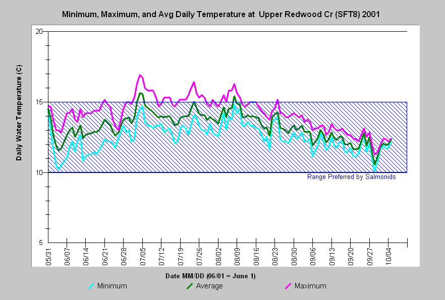 |
KRIS summarizes available water temperature data by providing several standard charts. The most informative chart for examining temperatures from a single location in a single year is the Daily Minimum, Maximum and Average chart. This chart illustrates the maximum temperature as well as the variation between daily minimum and maximums, also called the diel range. The data is shown with reference to the known preferred range of temperature for salmonids (Bret 1982). |
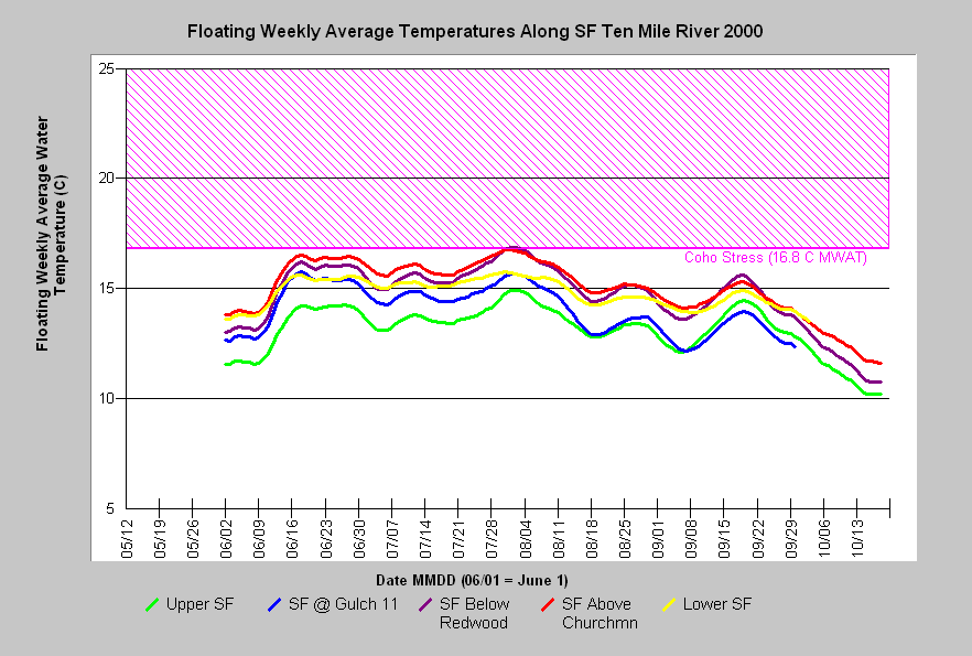 |
Floating weekly average temperature charts display the moving 7-day average temperature. These charts enable the comparison of temperature among several sites or among years for a particular site. The maximum point in the curves represents the maximum daily average temperature or MWAT. |
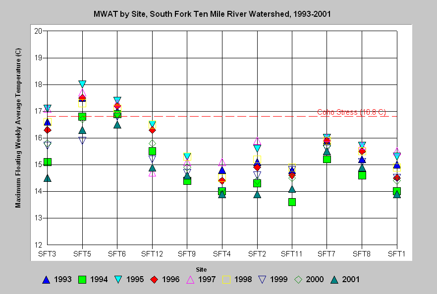 |
All available temperature data for streams monitored throughout summer can be summarized in a MWAT marker plot. This chart illustrates variation in MWAT among years and sites. It can be used to quickly ascertain potential trends in temperature or the available habitat for sensitive species. Where coho salmon are potentially present, this type of chart and the floating weekly average chart are shown with a reference line for the 16.8° C threshold described by Welsh et al. (2001). |
![]()
|
Table of Contents for Background Pages |
|||||
| Stream Conditions: | Water Quality | Sediment | Riparian | Big Wood | Habitat Types |
| Watershed Conditions: | Vegetation Types | Slope Stability | Roads & Erosion | Cumulative Impacts | Urbanization |
| Fish & Aquatic Life: | Fish Populations | Amphibians | Aquatic Insects | Hatcheries | Fish Disease |
| Restoration: | Stream Clearance | In-stream Structures | Riparian | Watershed | Strategy |
| Geology / Hydrology: | Geology | Soils | Precipitation | Stream Flow | Channel Processes |
| Policy & Regulation | ESA | TMDL | Forest Rules | 1603 Permits | Water Rights |
| www.krisweb.com |