| Area | South Fork |
| Topic | Tour: Map Images of SF Riparian Maps (USFS Landsat) |
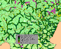
The riparian zone of the Brandon Gulch CalWater is shown above as a 90-meter clip of USFS vegetation and stand type data derived from a 1994 Landsat image. Medium-Large Trees (20-29.9" diameter) dominate many reaches but Small (5-11.9" diameter) and Small/Medium Trees (12-19.9") are also substantially represented. Only tributaries in the western portion of the basin show Saplings (<5" diameter) and Non-Forest components. Stands of Large Trees (30-39" diameter) were indicated in headwater areas. See InfoLinks for more information. This data is only accurate to the one-hectare scale and should be used only as a reconnaissance tool for riparian conditions.
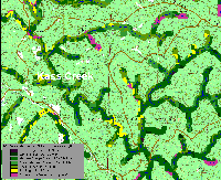
The riparian zone of the Kass Creek CalWater is shown above as a 90-meter clip of USFS vegetation and stand type data derived from a 1994 Landsat image. Small Trees (5-11.9" diameter) dominate much of the riparian zone of Kass Creek proper (upper part of CalWater) with patches of Non-Forest in headwater areas. The mainstem South Fork riparian zone (lower left stream course in CalWater) has stands of Medium/Large Trees (20-29.9" diameter) but also a contiguous area that reads as Saplings (<5" diameter) on the east side of one reach. See InfoLinks for more information. This data is only accurate to the one-hectare scale and should be used only as a reconnaissance tool for riparian conditions.
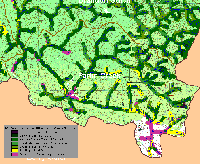
The riparian zone of the Parlin Creek CalWater is shown above as a 90-meter clip of USFS vegetation and stand type data derived from a 1994 Landsat image. Medium-Large Trees (20-29.9" diameter) dominate many reaches, particularly the mainstem South Fork below Parlin Creek. Stands of Small (5-11.9" diameter) and Small/Medium Trees (12-19.9") are also substantially represented. Saplings (<5" diameter) and Non-Forest components show primarily in headwater areas and around Parlin Camp. McGuire's opening, a private ranch at the top of the South Fork also shows up as Saplings and Non-Forest (as well as white on USGS topo). Stands of Large Trees (30-39" diameter) in headwater areas of the eastern Parlin Creek watershed. See InfoLinks for more information. This data is only accurate to the one-hectare scale and should be used only as a reconnaissance tool for riparian conditions.
 Click on image to enlarge (116K).
 Click on image to enlarge (114K).
 Click on image to enlarge (93K).
To learn more about this topic click here
| www.krisweb.com |
