| Area | Lower Noyo/Basin-wide |
| Topic | Sediment: Matthews Estimate of Contributions to Mass Wasting 1933-1999 |
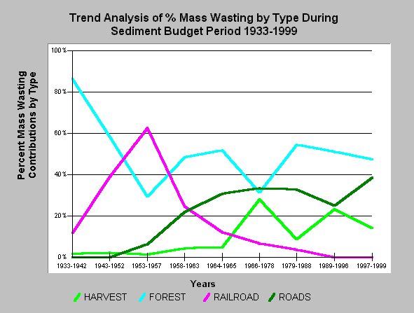
| Caption: Matthews (1999) estimated sediment yield from mass wasting in the Noyo Basin using aerial photos and found the trends shown above. Landslides in the earliest photos were predominantly in forests (86%) as opposed to areas recently harvested (within 15 years), while roads caused no landslides but the railroad bed was responsible for 12% of mass wasting. With increased timber harvest and road building in recent periods, these factors have increased in relative importance as triggers of mass wasting. Data treatment patterned after Matthews (1999) Sediment Source Analysis and Preliminary sediment Budget for the Noyo River. | |
 |
To learn more about this topic click here .
To view the table with the chart's data, click Chart Table web page.
To download the table with the chart's data, click sedimentsrc33_99.dbf (size 716 bytes) .
To see meta information about the data table used for this topic click here
| www.krisweb.com |
