| Area |
Rancheria Creek |
| Topic |
Tour: Upper Rancheria Creek and Tributary Beebe Creek 2001 |
 Click on image to enlarge (128K).
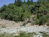
View of temporary road blocking Beebe Creek near Hwy 128. Notice down cut channel and angular bed material. Landing borders channel for several hundred feet. There is also evidence of grazing activity directly in the stream. Photo by Pat Higgins, 9/21/01.
 Click on image to enlarge (83K). Click here to display a larger version (728K).
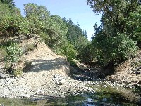
Looking upstream on Beebe Creek near Hwy 128. Pool in foreground is formed by temporary road near culvert landing. Notice down cut channel and angular bed material. There is also evidence of grazing activity directly in the stream. Photo by Pat Higgins, 9/21/01.
 Click on image to enlarge (53K). Click here to display a larger version (263K).
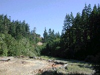
View of unnamed tributary to Beebe Creek near Hwy 128. Notice down cut channel and road adjacent to stream. It was also apparent on the day of the visit that grazing activity occurred directly in the channel. Photo by Pat Higgins, 9/21/01.
 Click on image to enlarge (87K). Click here to display a larger version (913K).
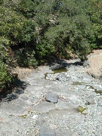
View of Beebe Creek near Hwy 128 looking upstream with exposed bedrock. Scouring from storm events has apparently removed most of the gravel from this portion of the channel. Photo by Pat Higgins, 9/21/01.
 Click on image to enlarge (56K). Click here to display a larger version (274K).
Looking downstream on Beebe Creek near Hwy 128. Old road and bridge abutment are on the right. Notice large, angular bed material. Isolated pools are shallow with little cover. Photo by Pat Higgins, 9/21/01.
 Click on image to enlarge (54K). Click here to display a larger version (689K).
Looking upstream on Rancheria Creek from Fish Rock Road Bridge. Notice highly aggraded channel in background with landing built on river terrace. Photo by Pat Higgins, 9/21/01.
 Click on image to enlarge (81K). Click here to display a larger version (874K).
Looking upstream on Rancheria Creek from Fish Rock Road Bridge. Flow is subsurface with small, shallow isolated pools in a highly aggraded channel filled with fine bed material. Photo by Pat Higgins, 9/21/01.
To learn more about this topic click Info Links
To view additional information (data source, aquisition date etc.) about this page, click Metadata
 Click on image to enlarge (128K).
 Click on image to enlarge (83K). Click here to display a larger version (728K).
 Click on image to enlarge (53K). Click here to display a larger version (263K).
 Click on image to enlarge (87K). Click here to display a larger version (913K).
 Click on image to enlarge (56K). Click here to display a larger version (274K).
 Click on image to enlarge (54K). Click here to display a larger version (689K).
 Click on image to enlarge (81K). Click here to display a larger version (874K).