
| Area | S.F. Trinity |
| Topic | Map: 1C. EPA Landcover/Landuse, SF Trinity Sub-Basin |
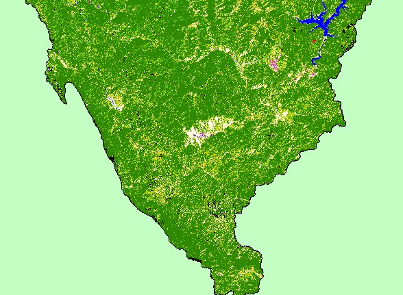
| This is a map of the EPA Landcover/Landuse in the Middle Trinity sub-basin, based on a 1992 Landsat TM satellite image. The majority of the sub-basin is conifers (dark green) and mixed conifer-hardwood (medium green). Most of the agriculture (orange color) in the sub-basin is located in the northwest corner in Hoopa Valley. | |||
 |
 |
||
To view metadata about a map layer, click on a link in the table below.
| Name of Layer in Map Legend | Metadata File Name |
|---|---|
| Frame Project Outline | Unavailable |
| EPA Landcover (1992 Aggregated) | lndcov2.tif.txt |
| EPA Landcover (1992 Unaggregated) | lndcov.tif.txt |
| Topographic Map (1:24k scale) | trinity.sid.txt |
| Project Area Background | trin_outl.shp.txt |
| www.krisweb.com |