
| Area | Salmon River |
| Topic | Map: Salmon River Vegetation |
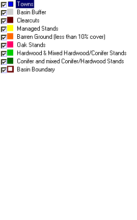
| This is a vegetation map of the Salmon River Project Area. | |||
 |
 |
||
To view metadata about a map layer, click on a link in the table below.
| Name of Layer in Map Legend | Metadata File Name |
|---|---|
| Towns | towns.shp.txt |
| Basin Buffer | buffer_basinboundary.shp.txt |
| Clearcuts | clearcuts.shp.txt |
| Managed Stands | sr_mgstands03.shp.txt |
| Barren Ground (less than 10% cover) | veg_bare.shp.txt |
| Oak Stands | veg_oak.shp.txt |
| Hardwood & Mixed Hardwood/Conifer Stands | veg_hardwood.shp.txt |
| Conifer and mixed Conifer/Hardwood Stands | veg_conifers.shp.txt |
| Elevation (in Meters) | sr_elevation.tif.txt |
| Hillshade | srhillshade.tif.txt |
| Basin Boundary | basin_bnd.shp.txt |
| www.krisweb.com |