| Area | Middle Klamath |
| Topic | Tour: 2002 Photo Points of Clear Creek and Dogget Creek |
This photo shows Clear Creek at Hwy 96 Bridge with smoke from large Oregon wildfires coloring the landscape orange and clouding the sky at the horizon. This is a popular recreational swimming spot. Clear Creek is an important stream for Chinook salmon and steelhead, including one of the larger summer steelhead populations in the Klamath Basin in some years. Photo contributed by Michael Hentz. 2002.
This photo shows Clear Creek looking downstream off the Highway 96 Bridge. Note the outstanding clarity of the creek. The structural cement frame at left is the old Highway 96 Bridge which was washed out in the 1964 Flood. Photo contributed by Michael Hentz. 2002.
This photo shows Clear Creek at Scenic Bridge. Photo contributed by Michael Hentz. 2002.
This photo shows Clear Creek at Scenic Bridge. Note that fine sediment is only in the bottom of the pool and that gravel in the downstream reach appears optimal for salmonid spawning. Photo contributed by Michael Hentz. 2002.
This photo shows Clear Creek at Slippery View Put-In. Photo contributed by Michael Hentz. 2002.
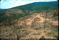
This photo shows Dogget Creek at a site that appears to have been salvage logged. Forest health here appears poor. Snag removal as a result of salvage logging leaves no shade for seedling conifers, which can lead to take over by manzanita and ceanothus. Compaction of soils by equipment and loss of top soil as a result of silvicultural activities are also likely to have implications for productivity with regard to future tree growth. Photo contributed by Michael Hentz. 2002.
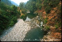 Click on image to enlarge (121K).
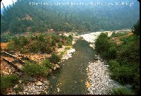 Click on image to enlarge (108K).
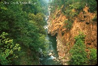 Click on image to enlarge (129K).
 Click on image to enlarge (124K).
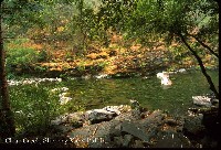 Click on image to enlarge (135K).
 Click on image to enlarge (119K).
To learn more about this topic click Info Links
To view additional information (data source, aquisition date etc.) about this page, click Metadata
| www.krisweb.com |
