
| Area | Middle Klamath |
| Topic | Map: Mid Klamath Regions (hotlinked) |
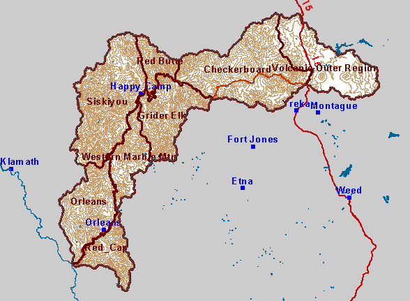
| This is a map of the Regions in the Middle Klamath. Each region (brown-outlined polygon) in this map is hotlinked to a more detailed map. To view a more detailed map of a Region, click on that Region. | |||
 |
 |
||
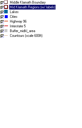
To view metadata about a map layer, click on a link in the table below.
| Name of Layer in Map Legend | Metadata File Name |
|---|---|
| Middle Klamath Boundary | midkl_area.shp.txt |
| Mid Klamath Regions (w/ labels) | md_regions.shp.txt |
| Lakes | lakes.shp.txt |
| Cities | kb_cities.shp.txt |
| Highway 96 | hwy_96.shp.txt |
| Interstate 5 | i5.shp.txt |
| Buffer_midkl_area | buffer_midkl_area.shp.txt |
| Countours (scale 600ft) | mid600ctours.shp.txt |
| Elevation (in meters) | mk_elev.tif.txt |
| Grey Hillshade | mk_hlshd.tif.txt |
| www.krisweb.com |