
| Area | Middle Klamath |
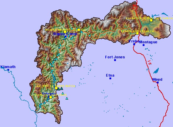
| Topic | Map: Mid Klamath USGS Gage Stations (hotlinked) |
| This is a map of the Middle Klamath USGS flow gage stations. Stations are hotlinked to USGS web pages containing real-time data. To access real-time data for a station, click on a yellow rectangle. | |||
 |
 |
||
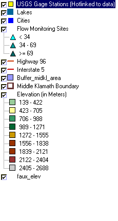
To view metadata about a map layer, click on a link in the table below.
| Name of Layer in Map Legend | Metadata File Name |
|---|---|
| USGS Gage Stations (Hotlinked to data) | md_gs_utm.shp.txt |
| Lakes | lakes.shp.txt |
| Cities | kb_cities.shp.txt |
| Flow Monitoring Sites | flow_sites.shp.txt |
| Highway 96 | hwy_96.shp.txt |
| Interstate 5 | i5.shp.txt |
| Buffer_midkl_area | buffer_midkl_area.shp.txt |
| Middle Klamath Boundary | midkl_area.shp.txt |
| Elevation (in Meters) | mk_elev.tif.txt |
| Grey Hillshade | mk_hlshd.tif.txt |
| faux_elev | faux_elev.shp.txt |
| www.krisweb.com |