
| Area | Lower Trinity/Basin-wide |
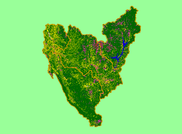
| Topic | Map: 1F. USFS Vegetation Type, Trinity Basin |
| This is a map of 1999 USFS Landsat vegetation type data in the Trinity basin. Unlike the tree size coverage in the previous Topic, this map differentiates between hardwoods and conifers. | |||
 |
 |
||
To view metadata about a map layer, click on a link in the table below.
| Name of Layer in Map Legend | Metadata File Name |
|---|---|
| Subbasins (no labels) | subbasins_trin.shp.txt |
| Frame Project Outline | Unavailable |
| USFS Vegetation Type (1999) | vegtype.tif.txt |
| USFS Riparian Veg Size (1999) | vegszbuf99.tif.txt |
| USFS Vegetation Size (1999) | vegsize.tif.txt |
| Topographic Map (1:24k scale) | trinity.sid.txt |
| Project Area | trin_outl.shp.txt |
| www.krisweb.com |