
| Area | Lower Trinity/Basin-wide |
| Topic | Map: 1E. USFS Vegetation Size, Trinity Basin |
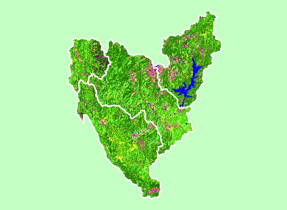
| This is a map of 1999 USFS Landsat-based vegetation size data for the Trinity basin. The vegetation classification is accurate at a one-hectare scale (approximately 11 pixels) and is suitable for stand classification. Data provided by the U.S. Forest Service Spatial Analysis Lab in Sacramento, CA. | |||
 |
 |
||
To view metadata about a map layer, click on a link in the table below.
| Name of Layer in Map Legend | Metadata File Name |
|---|---|
| Subbasins (no labels) | subbasins_trin.shp.txt |
| Subbasins (no labels) | subbasins_trin.shp.txt |
| Frame Project Outline | Unavailable |
| Lakes | tc_lakes.shp.txt |
| USFS Riparian Veg Size (1999) | vegszbuf99.tif.txt |
| USFS Vegetation Size (1999) | vegsize.tif.txt |
| Change in Veget. (1994-98)(TIFF) | vegchg.tif.txt |
| Topographic Map (1:24k scale) | trinity.sid.txt |
| Project Background | trin_outl.shp.txt |
| www.krisweb.com |