|
Area/Topic | Bibliography | Background | Hypotheses | Home |
Photo Pages: Meta Information
This page contains detailed information from the KRIS Photodatabase table about photos from sub-basin Petaluma River and series Monitoring: WQ- Map of chlorpyrifos sampling stations in Upper Petaluma River Watershed 1998. For a list of photo pages sorted by series, click here. For a list of photo pages sorted by sub-basin, click here.
| Agency | Petaluma Tree Planter |
| Basin | East Marin-Sonoma |
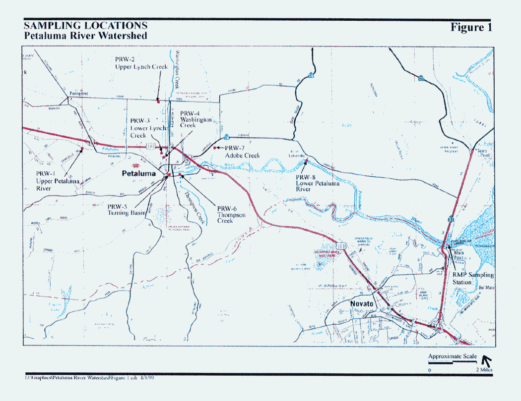
| Caption | This map shows the locations of water quality sampling conducted in the Petaluma River watershed in 1998 by Petaluma Tree Planters. (Source: Petaluma Tree Planters, 1999) |
| CaptionTemplate | [Description] |
| Category | Monitoring |
| Description | This map shows the locations of water quality sampling conducted in the Petaluma River watershed in 1998 by Petaluma Tree Planters. (Source: Petaluma Tree Planters, 1999) |
| Filename | map_petaluma_diazchlor_ptp_1998.gif |
| Filesize | 53857 |
| Meta_Id | PTP_wq |
| Notefile | emarins.htm#wq |
| Path | topics/pr/map_petaluma_diazchlor_ptp_1998.gif |
| Photo Number | 1 |
| Restriction | None |
| Series | Monitoring: WQ- Map of chlorpyrifos sampling stations in Upper Petaluma River Watershed 1998 |
| SubBasin | Petaluma River |
| UpdateDate | 8/26/2006 |
| UpdateName | JEA |
| www.krisweb.com |