Photo Pages. Photos on this page are from sub-basin Mainstem Sheepscot
and series Monitoring- MDEP Water Quality Monitoring Sites.
Click on any thumbnail to see a larger photo.
For detailed information on these photos click here.
118 KB
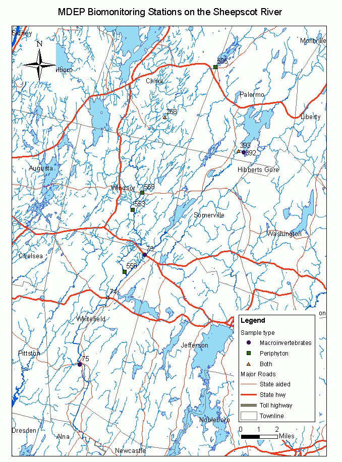
This map shows the location of Maine Department of Environmental Protection (biomonitoring program) stations in the Sheepscot River watershed sub-basin.