
| Area | Laguna |
| Topic | Tour: 1940 Aerials - Sebastopol to Mark West Creek |
This photo shows the Laguna to the east of Sebastopol. Photo taken by the U.S. Army Corp of Engineers in March 1940 and provided in digital form by Phillip Williams and Associates. Flood contours were drawn on originals.
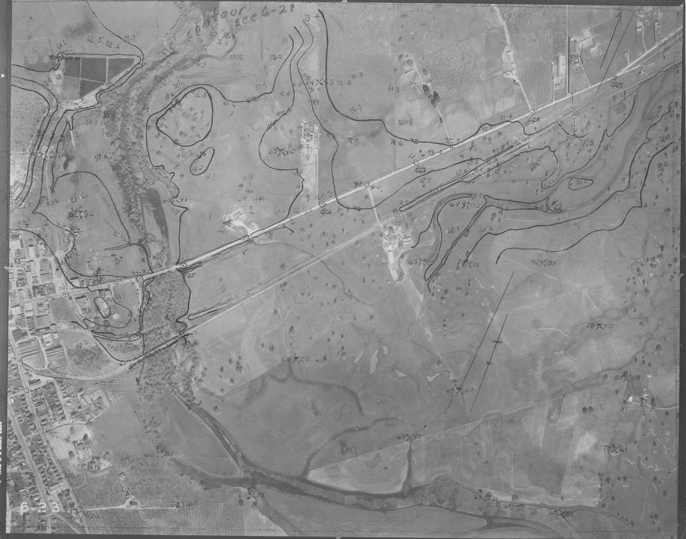
This photo shows the Laguna in the vicinity of Sebastopol. Photo taken by the U.S. Army Corp of Engineers in March 1940 and provided in digital form by Phillip Williams and Associates. Flood contours were drawn on originals.
This photo shows the Laguna to the north of Sebastopol and crossed by Occidental Road. Photo taken by the U.S. Army Corp of Engineers in March 1940 and provided in digital form by Phillip Williams and Associates. Flood contours were drawn on originals.
This photo shows the Laguna to the north of Sebastopol and adjacent to Hall Road. Photo taken by the U.S. Army Corp of Engineers in March 1940 and provided in digital form by Phillip Williams and Associates. Flood contours were drawn on originals.
This photo shows the Laguna in the vicinity of Guerneville Road and Santa Rosa Creek. The intersection with Olivet is in the frame. Photo taken by the U.S. Army Corp of Engineers in March 1940 and provided in digital form by Phillip Williams and Associates. Flood contours were drawn on originals.
This photo shows the Laguna to the north of Sebastopol and crossed by Guerneville Road. Photo taken by the U.S. Army Corp of Engineers in March 1940 and provided in digital form by Phillip Williams and Associates. Flood contours were drawn on originals.
This photo shows the Laguna to the north of Guerneville Road. Note the extensive standing water. Photo taken by the U.S. Army Corp of Engineers in March 1940 and provided in digital form by Phillip Williams and Associates. Flood contours were drawn on originals.
This photo shows the Laguna in the vicinity of River Road and Mark West Creek. Note the alluvial fans and disappearance of a defined channel at the confluence of Mark West Creek. Photo taken by the U.S. Army Corp of Engineers in March 1940 and provided in digital form by Phillip Williams and Associates. Flood contours were drawn on originals.
 Click on image to enlarge (131K).
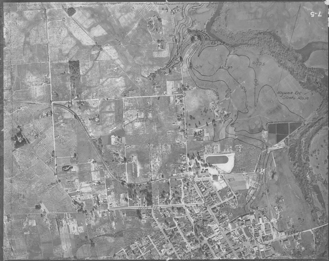 Click on image to enlarge (200K).
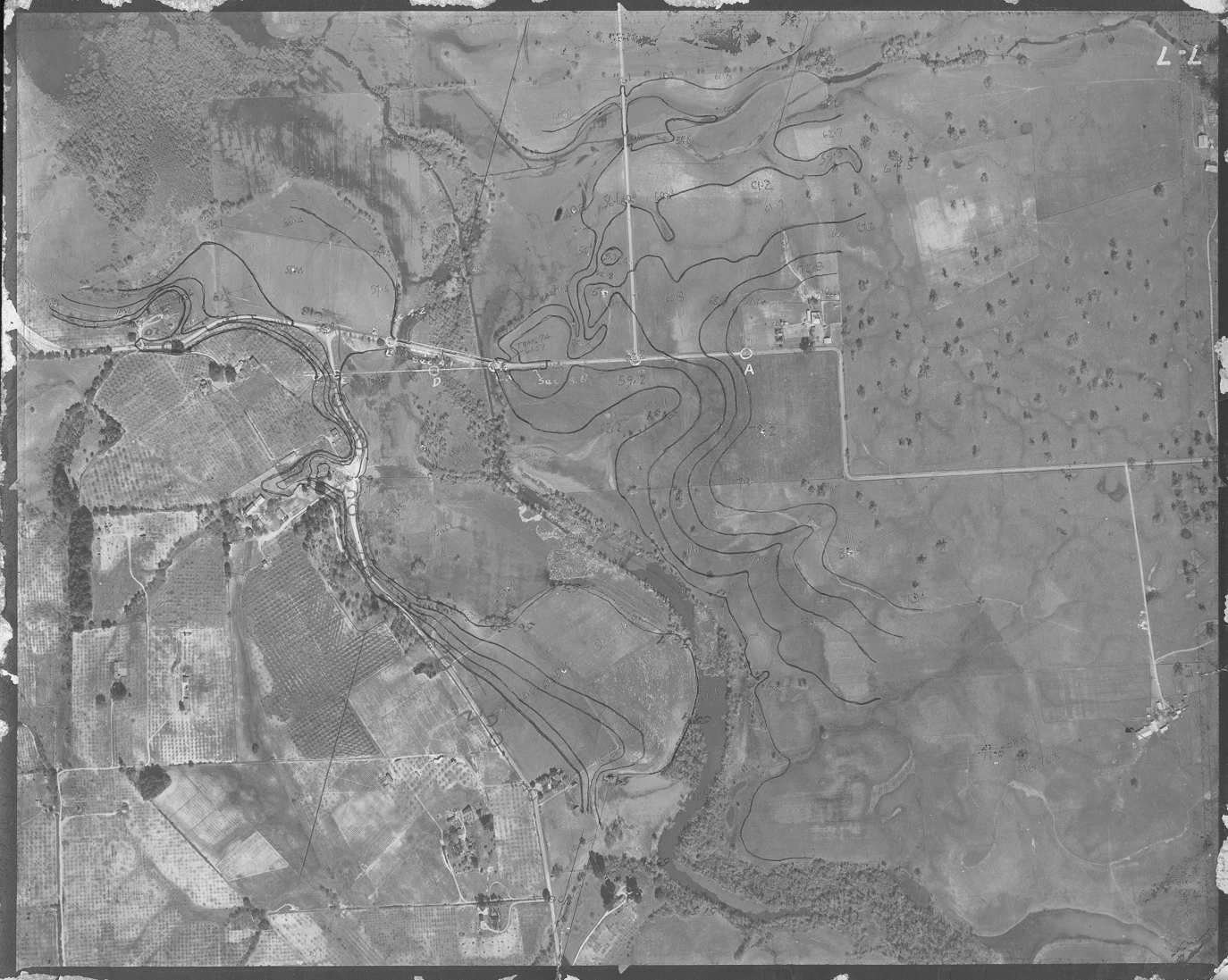 Click on image to enlarge (159K).
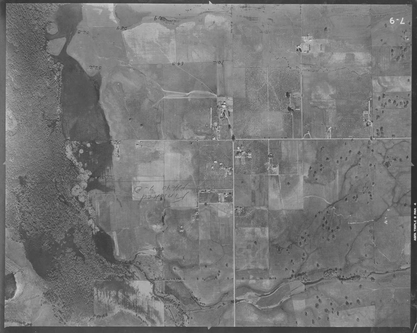 Click on image to enlarge (146K).
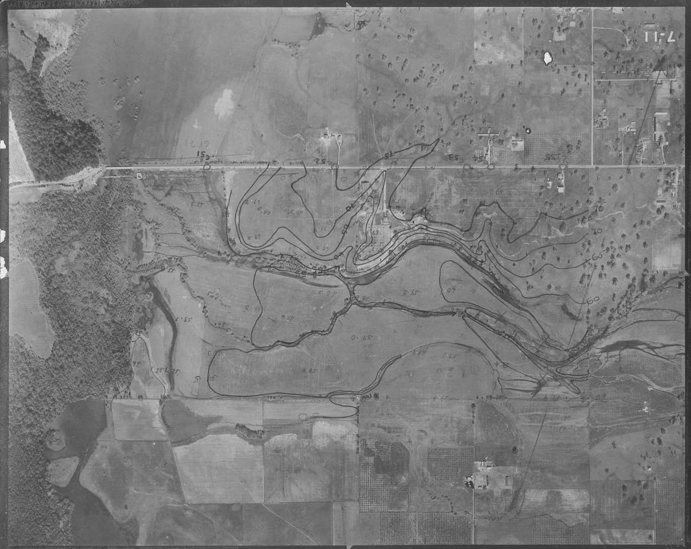 Click on image to enlarge (226K).
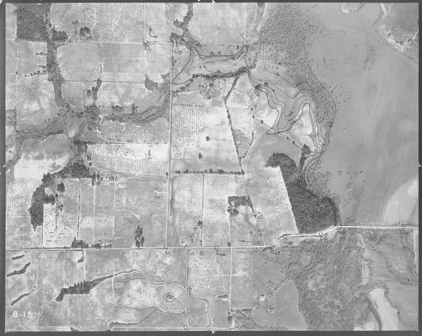 Click on image to enlarge (187K).
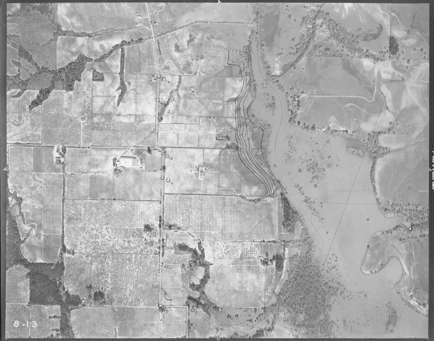 Click on image to enlarge (172K).
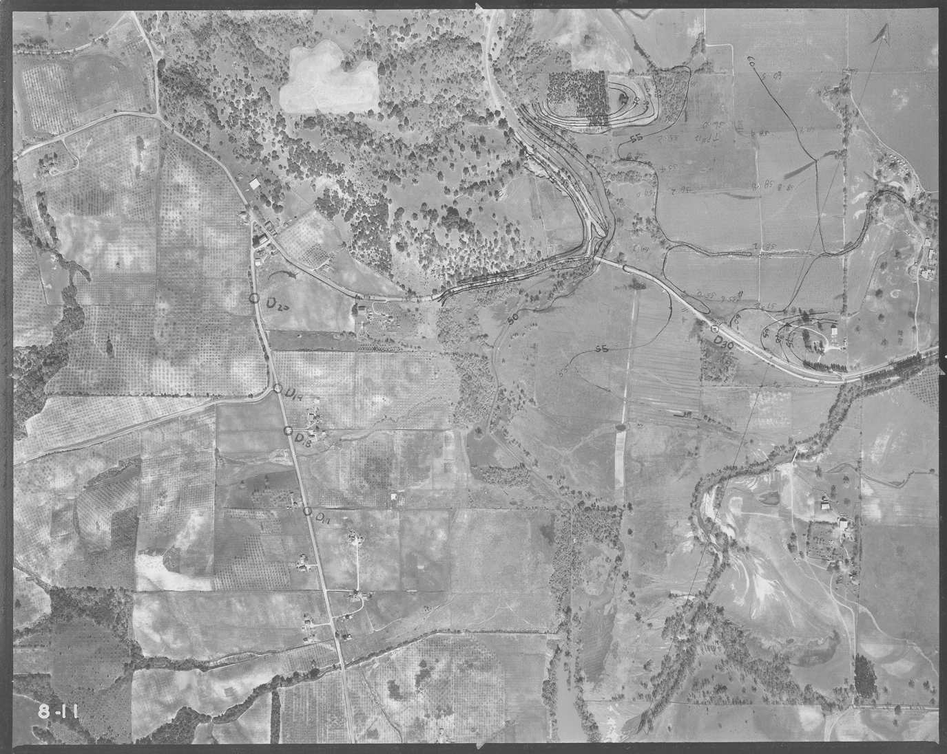 Click on image to enlarge (180K).
To learn more about this topic click Info Links
To view additional information (data source, aquisition date etc.) about this page, click Metadata
| www.krisweb.com |